Traditionally, seismic and geodetic networks are two independent networks used for the observation of earthquakes at regional distances. They are seldom collocated due to the lack of knowledge about multi-sensor fusion at the very beginning. Gradually, geoscientists come to realize that the range of seismic motions is broad and no sensor can capture all signals of interest to seismology and earthquake engineering.
Strong motions and seismometers are precise enough in recording high-frequency seismic signals but for low-frequency part they have relatively low precision. Computation of broadband displacements from inertial sensors is fraught with many known problems and has no recognized single solution. For example, unresolved rotational motions is a major impediment in retrieving precise displacements for that small offsets in the acceleration time series would produce linear and quadratic errors in integration process. Consequently displacement waveforms would grow unbounded as time progresses. A traditional approach to suppress the divergence is applying high-pass filter on acceleration time series but at the cost of loss of permanent displacements.
GNSS technique can directly capture ground motions in displacement forms and an emerging field named GNSS seismology has been catching geoscientists’ attention. The advantage of GNSS technique is that it can recover permanent co-seismic displacements and is free of clipping in large earthquakes. Nevertheless, it has larger noises than inertial sensors in the full spectrum band. This leads to inaccurate signals in high-frequency band and also for small earthquakes.
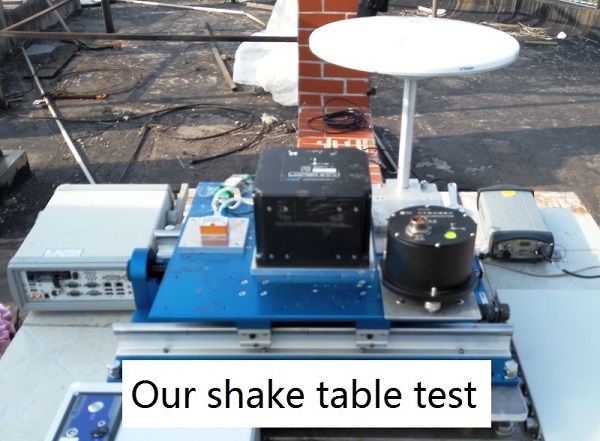
So it is not surprising that some scholars advocate combining seismic and geodetic data to get optimal broadband displacements because they are complementary in the sense that one’s weakness can be complemented by another strengths. Following this viewpoint, we also made a number of impressive advanced works. In 2013, we proposed a tightly coupled Kalman filter approach to estimate seismogeodetic displacements and velocities from GPS phase and pseudorange observations and collocated seismic accelerations in a PPP-AR process and can be used in early warning systems; in the same year, we also proposed a method on how to recover coseismic point ground tilts from collocated high-rate GPS and accelerometers. In 2017 and 2018, we proposed integrating GPS with GLONASS for highrate seismogeodesy and high-rate multi-GNSS for subdaily crustal deformation monitoring respectively which present the role of multi-GNSS in seismogeodesy to us. In 2019, we further developed the multi-sensor fusion method by adding gyroscope data in the combination of collocated high-rate GNSS and accelerometers to correct accelerometer measurements.
Related works
1. Six‐Degree‐of‐Freedom Broadband Seismogeodesy by Combining Collocated High‐Rate GNSS, Accelerometers, and Gyroscopes. Geophysical Research Letters (2019)
2. Noise characteristics of high-rate multi-GNSS for subdaily crustal deformation monitoring. Journal of Geophysical Research (2018)
3. Integrating GPS with GLONASS for highrate seismogeodesy. Geophysical Research Letters (2017)
4. Recovering coseismic point ground tilts from collocated high-rate GPS and accelerometers. Geophysical Research Letters (2013)
5. A new seismogeodetic approach applied to GPS and accelerometer observations of the 2012 Brawley seismic swarms: Implications for earthquake early warning. Geochemistry, Geophysics, Geosystems (2013)
Copyright PRIDELAB IN GNSS CENTER , Wuhan University Visits:238610 Powered by Truesing