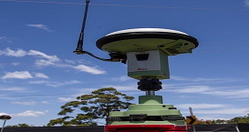
High-rate GPS has the potential to record crustal motions on a wide subdaily timescale from seconds to hours, but usually fails to capture subtle deformations which are often over- whelmed by the centimeter noise of epoch-wise GPS displacements. This is especially valuable in the near-source where broadband seismometers are likely to clip and accelerometer data cannot be objectively integrated to produce reliable displacements in real time. We describe a new seismogeodetic approach that applies a tightly coupled Kalman filter to GPS and accelerometer data at the observation level as an extension of the GPS-only PPP-AR approach to estimate seismogeodetic displacement and velocity wave forms in both horizontal and vertical components. The performance of high-rate GPS is usually improved by sidereal filtering to mitigate multipath effects dominating the periods of tens of seconds to minutes. However, we find that the integration of GPS and GLONASS can reduce the noise of high-rate GPS significantly and near uniformly over the entire frequency band, which outperforms GPS sidereal filtering over a wide frequency band except a minor portion between 100 and 1000 s. Next, we further investigate how we can exploit multi-GNSS data to ameliorate the precision of high rate solutions, especially in case of BeiDou which delivers positioning services in Asia-Pacific areas and differs from other GNSS such as GPS and GLONASS in orbital configuration.

Fig.1 Comparison of the vertical component of 60 s seismic velocity waveforms measured by the STS2 seismometer and loosely coupled and tightly coupled Kalman filter output from P494/WES. Note that only the first (Mw=5.4) earthquake is shown for Event 2. This figure shows that tightly coupled filter outperforms loosely coupled counterpart in mitigating the long-wavelength biases related to the time-varying biases in the accelerometer data.

Fig.2 Averaged power spectral density (PSD, dB) over all 99 stations on all 31 days (about 2200 solutions) for the north, east and up components spanning a frequency band from 2 to 50000 s. All five types of solutions are presented of which the float solutions (dashed curves) are only shown in the two insets while two fixed solutions (black and red curves) shown twice in the insets and the main panels. The vertical dashed orange lines denote particular periods between 0.5 days and 2.5 s. The frequency content in the insets is truncated at 0.002 Hz for clarity of low-frequency portions. This figure shows that introducing GLONASS, instead of sidereal filtering, can always lead to reduced noise with respect to high-rate GPS over the entire frequency band for all three components.

Fig.3 Averaged power spectral density (PSD,dB) on a frequency band from 2 to 50,000s over all 15 stations on all 24 days for the east, north and up components. Three types of solutions, i.e., GPS only, GPS ORT (orbital repeat time) filtered and GPS/GLONASS/BeiDou ORT filtered solutions, are exhibited with black, blue and red curves, respectively. Vertical yellow dashed lines denote a few particular periods. All PSDs are converted into dB relative to 1cm2/Hz. Refer to Figure S1 for receiver type dependent PSDs. This figure shows that if all GPS/GLONASS/BeiDou data are used and each augmented by ORT filtering, the PSDs across almost the entire frequency band decline substantially and near uniformly by 3 to 8 dB in contrast to the GPS only solutions.
Related Works
1. Geng J*, Bock Y, Melgar D, Crowell B W, Haase J S (2013) A new seismogeodetic approach applied to GPS and accelerometer observations of the 2012 Brawley seismic swarms: Implications for earthquake early warning. Geochem. Geophys. Geosyst., 14, 2124-2142, doi:10.1002/ggge.20144
2. Geng J*, Pan Y, Li X, Guo J, Liu J, Chen X, Zhang Y (2018) Noise characteristics of high-rate multi-GNSS for subdaily crustal deformation monitoring. J. Geophys. Res. 123(2):1987-2002, doi:10.1002/2018JB015527
3. Geng J*, Jiang P, Liu J (2017) Integrating GPS with GLONASS for highrate seismogeodesy. Geophys. Res. Lett. 44, 3139-3146. doi:10.1002/2017GL072808
Copyright PRIDELAB IN GNSS CENTER , Wuhan University Visits:171843 Powered by Truesing