A megathrust event struck southern Mexico's Pacific coast on Tuesday. SSN (Servicio Sismólogico Nacional) and USGS (United States Geological Survey) provided slightly different epicenter location for this event.
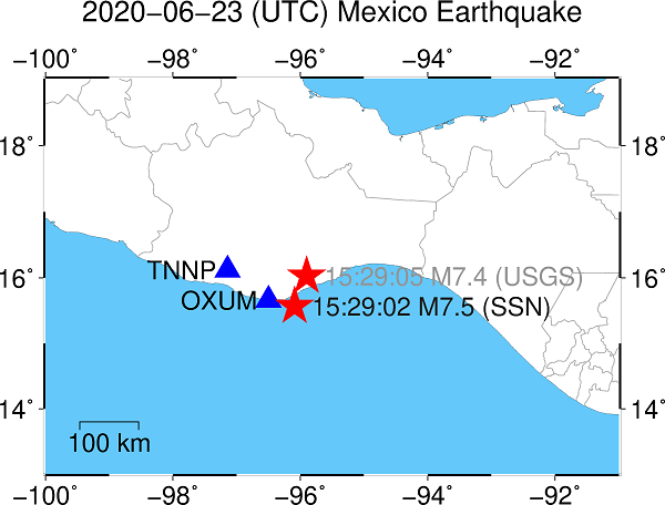
According to USGS, the origin time is 2020-06-23 15:29:05 (UTC) and the magnitude is 7.4. The location is (16.029°N, 95.901°W). According to SSN, the origin time is 2020-06-23 15:29:02 (UTC) and the magnitude is 7.5. The location is (15.57°N, 96.09°W).
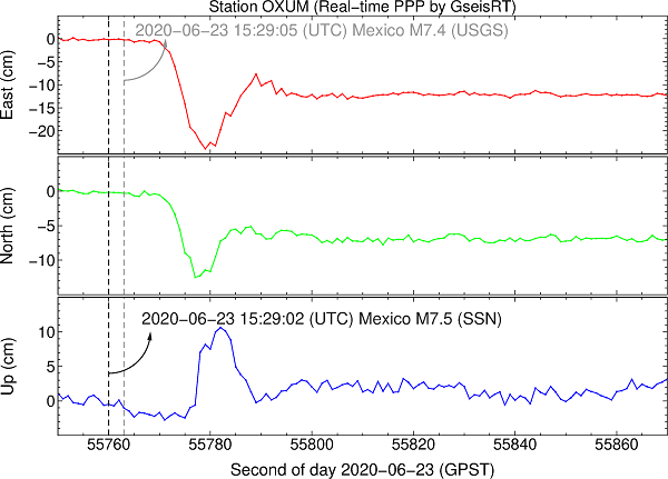
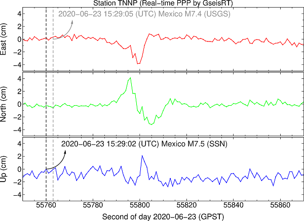
The GSeisRT software of PRIDE Lab has successfully captured this event in real-time using GNSS real-time precise point positioning. OXUM and TNNP stations closed to the epicenter were processed in real-time at that time. The distribution map and the real-time displacement figures are displayed at the end. According to the general velocity (about 4km/s) of the seismic wave, our results are better agreed with the epicenter provided by SSN. According to the coordinates, that means the epicenter is probably located in the southern sea area.
Moreover, we calculated PGD (Peak-Ground Displacement) of each station and used the scaling law proposed by Crowell for PGD to calculate the magnitude of this earthquake. According to our results, when we adopt the information of USGS, the magnitudes calculated by OXUM and TNNP stations’ displacements are 7.46 and 6.75. When we adopt the information of SSN, the magnitudes calculated by OXUM and TNNP stations’ displacements are 7.18 and 6.73.
June 24, 2020 California, USA, M5.8 earthquake
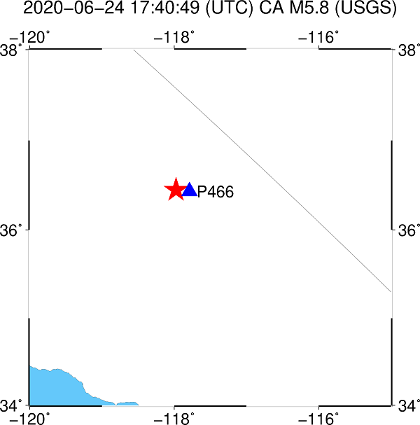
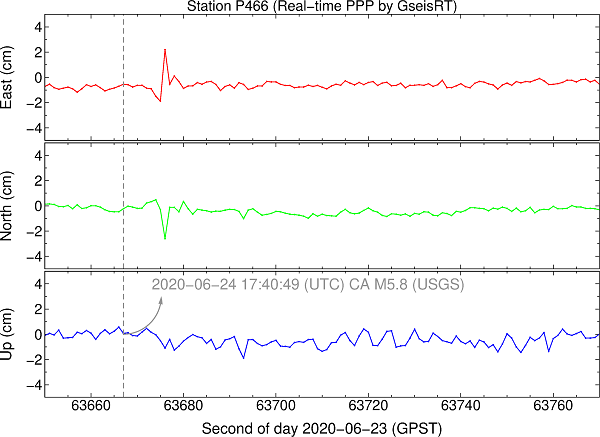
A preliminary 5.8 magnitude earthquake struck near Lone Pine, California on Wednesday. According to USGS, the origin time is 2020-06-24 17:40:49 (UTC) and the magnitude is 5.8. The location is (36.447°N 117.975°W).
Among the stations near the epicenter processed by GSeisRT in real-time, P466 station has captured obvious seismic signals in the horizontal components. The distribution map and the real-time displacement figure are displayed at the end. According to the real-time displacements of P466, the magnitude calculated by the PGD method is 5.73.
The results demonstrate that GNSS displacements can be used to rapidly determine the large earthquake magnitude precisely. The GSeisRT software has been installed in CEA, UNAVCO and CSN for operational processing.
Copyright PRIDELAB IN GNSS CENTER , Wuhan University Visits:173478 Powered by Truesing